Centuries and centuries ago, aboriginal (native) dogs of similar type were originally distributed over a vast area in the taiga forest zone of Northeastern Europe, from Finland eastward, including Karelia, provinces of the European part of Russia, and Siberia. In some areas the dogs were more agouti gray and red-and-white. Black-and-white and solid black dogs also occurred in pockets across eastern Europe and western and eastern Siberia.
Native Ugro-Finnish tribesmen who lived their lives and hunted with their aboriginal dogs inhabited a vast region--stretching from the Kola Peninsula and northwestern parts of European Russia, including Petersburg province, Ladoga Lake region, Kirov (Vyatka), Komi, Arkhangelsk and Vologda provinces, southward towards middle part of the Volga river, and eastward across Siberia to the Ural Mountains, widening from southern Yakutia in the north to the Amur River in the south.
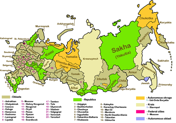
Below, the Kola Peninsula (part of the Murmansk Oblast), Karelia, Arkangelsk and Vologda are shown at top left. The middle of the Volga river takes us southward to Samara (number 15 on the map). Eastward to the Ural Mountains takes us into the Komi Republic, southward through Perm and Chelyabinsk to Orenburg. Traveling eastward through Siberia, southern Yakutia is pictured in green in the eastern third of the map and borders with Amur (just to the south). The Amur River flows along the southern border of Amur, forming the border between the Russian Far East and Manchuria in northeast China.
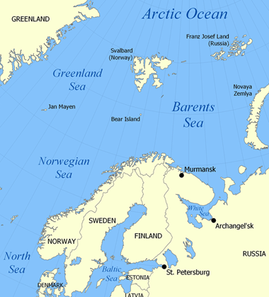
Below, the area described above is bounded in the northwest by the Kola Peninsula, a peninsula in the far north of Russia, part of the Murmansk Oblast. It borders upon the Barents Sea on the North and the White Sea on the East and South. The peninsula is shaped like a finger that is pointing east. It is covered by taiga in the south and tundra in the north.
|
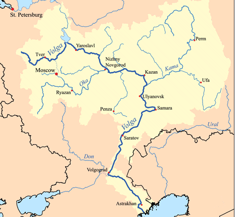
Below, the Volga, widely viewed as the national river of Russia, flows through the western part of the country. It is Europe's longest river. As a reference point for locating the middle part of the river, locate Samara (number 15 in the map of Russia at the top of the page) in the southwestern Russia.
|
Yakutia can be clearly seen in the northeastern part of Russia (in green in the map at the top of the page). Between the western part of the taiga described above and Yakutia, you must go through parts of Siberia.
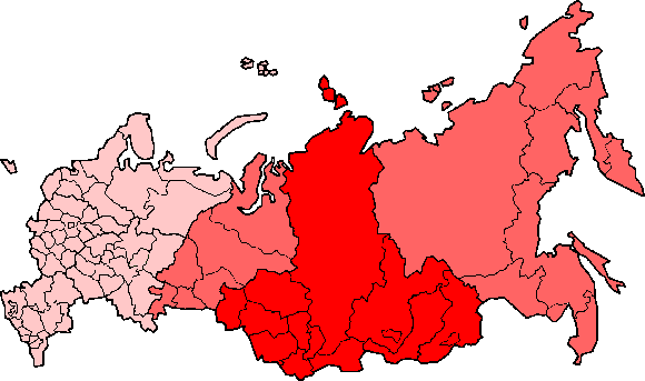
Below, using a map of Russia, you can see that Siberia is a vast region that extends eastward from the Ural Mountains to the Pacific Ocean, and southward from the Arctic Ocean to the hills of north-central Kazakhstan and the borders of both Mongolia and China. All but the extreme south-western area of Siberia lies in Russia, and Siberia makes up almost 60% of the total area of Russia. Below, in dark red is Federal Siberia. The light red (on either side) represents popular scientific Siberia.
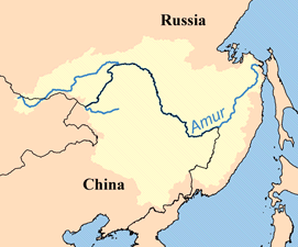
Below, the Amur River, located in the southeastern part of Russia, is Earth's eighth longest river, forming the border between the Russian Far East and Manchuria in northeast China.
|